Using Topographic Maps for Better Bass Fishing
When first trying to decide where to start fishing a specific area for bass, you should take into account the layout of the lake. If you want to give yourself a better chance to catch largemouth bass, it's not enough to just choose a location and start casting. I’m sure you know, that's a recipe for a long day of fishing, without the catching.
Sometimes we go out to spots where we have seen a bunch of people in the past thinking “There must be something here if all those people were here the other day”. Sometimes this works, people wouldn't continuously fish a spot day after day if there was nothing there right?
***Wait a minute, have I done that, have you done that?***
Maybe you’ve had some success trying these tactics but not nearly enough. You need to take control of your fishing day and a part of that is identifying potential fish holding areas.
In short you need to do your homework. And the more “studying” you do the better your chance of landing your prize lunker.
This studying should start with maps. If catching more bass is the goal, topographic maps are must in your bass fishing arsenal.
What are Topographic maps and what you should look for
I believe topo maps are the 1st tool to being a successful bass angler. I also believe they are the most underused tool and for that reason a lot of people miss out on catching more fish, more often.
Topographic lake maps are great because they show contours and depths of the entire lake. They sometimes show any old roads that use to run through the area before the lake was made. They can also show any old bridges or pilings and railroad tracks that may have run through the area in the past. All this is structure. (We’ll talk more about structure later on.)
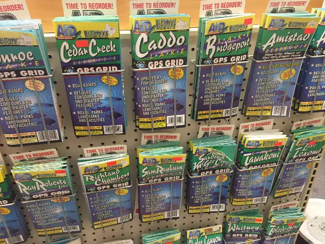
For this reason you need a good topographic map of the body of water you want to fish. Most will agree that it’s good to have a good ole paper lake map. You can find these in the sporting good section of your favorite megastore or the fishing dept. of any outdoors shop.
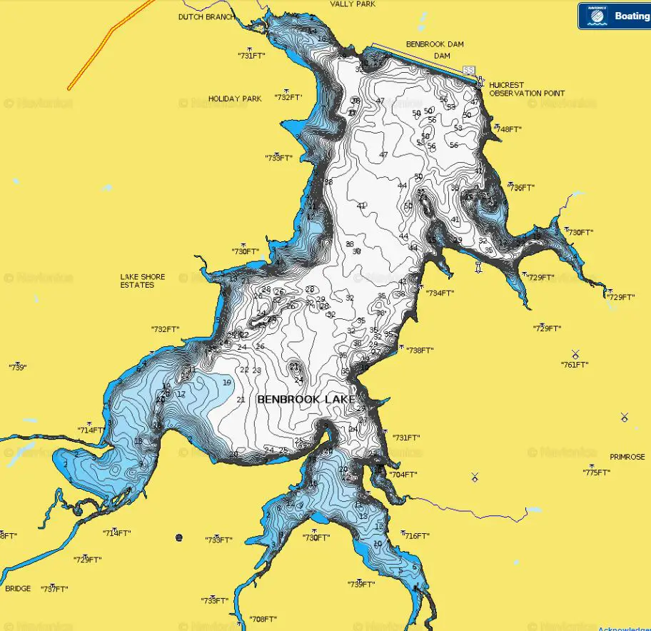
If you are a technology geek like me, then you can go digital with your maps. Navionics has topo maps via their iPhone app. Since I always have my phone with me, this is what I use the most, both when I’m fishing from the boat or the shore.
Not to mention some fish finders also contain maps as part of their function. This is perfect if you are out on a boat and can afford these higher end fish finders.
There are also sources online where you can find digital topo maps. Again, Navionics has a great topo maps to get you started via your computer. A quick google search on the subject should bring more options but we’ll go with Navionics to show some examples
Check out the Libre Map Project for free topographic maps. You can download topo maps. This site works best for larger lakes as smaller ones don't have a lot of the detail but you may get some info that you could use.
To start the process of identifying fishing spots that may hold your next lunker you need to look at your chosen topo map and start identifying obvious structure. There is a ton of structure all over a lake. If you are dealing with a massive lake or are fishing from shore then pick a section on the map that is accessible to you or close to where you are launching your boat.
Types of structure to identify on a lake map
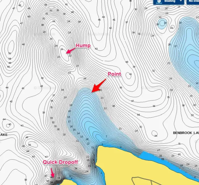
- Points: A point is where the shore extends out into the water to form a “point” in the water. These are the most popular places to start because there are usually some points accessible to everyone and bass love to hang out around them.
- Underwater humps: These are identified by small circles or ovals with a marked depth less than the water around the area. These are great holding areas when conditions force bass to move into deep water.
- Dropoffs and Ledges: You can identify these by closely grouped contour lines. The depth markers show a rapid increase in depth. Ledges will have a little more spacing between but will have noticeable quick depth changes.
- Riverbeds, creeks and old roads: You can mark these on the map by looking for long running deep spots that have shallower lines on both sides. They can give the appearance of a valley. As for roads, these will typically be pointed out on maps as such.
These are the most common types of structure to take note of when reading a topographic lake map. We’ll go more in depth on structure and cover in the next section.
What’s next?
Go find a map of your local lake and start studying! You can start with the links above.
If you already use maps tell us what your favorite piece of structure is to fish.


New! Comments
Let us know what you think! Leave us a comment in the box below.